
Geoinformatics
It is a state-of-the-art research and development facility, offering a wide range of capabilities in the areas of GIS data analysis, 3D modelling, the creation of thematic maps, and the processing of satellite imagery and LiDAR data
Geoinformatics utilises advanced GIS tools, remote sensing and cloud technologies to support projects in the fields of the environment, urban planning, transport, precision agriculture and spatial planning. The laboratory also supports educational, project-based and consultancy activities, offering access to specialist software, datasets and expert knowledge in this field of geoinformatics.
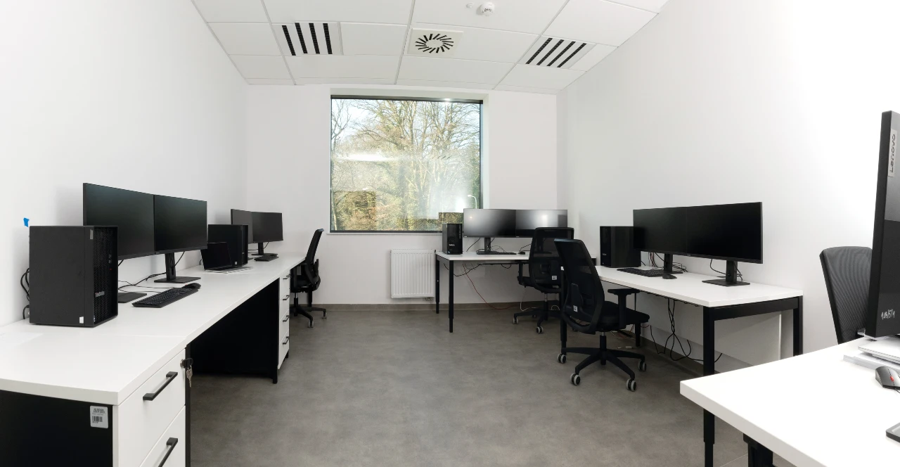
The laboratory is equipped with a high-performance server and five workstations, which enable the comprehensive processing of satellite, aerial and drone imagery, as well as LiDAR data, and allow for their interpretation and the extraction of the required geospatial information.
Geoinformatics at PTK involves the efficient processing and analysis of large spatial datasets derived, amongst other sources, from satellite imagery, LiDAR measurements and GNSS systems. The integrated working environment enables not only data processing, but also its intuitive visualisation and interpretation in a spatial context.
The laboratory uses specialist GIS software which enables the comprehensive processing, analysis and modelling of spatial data, including object-based classification, analysis of changes in land cover, 3D modelling of the urban environment, and the integration of data from various sources.
We are able to develop and implement geoportals – online platforms that support the interactive presentation and distribution of geospatial analysis results. This solution enables effective data management, control of access to resources and collaboration with various user groups – from GIS specialists, through public administration, to end users. The Centre’s services are aimed at academic institutions, geoinformatics companies and organisations involved in the analysis and processing of aerial and satellite imagery.
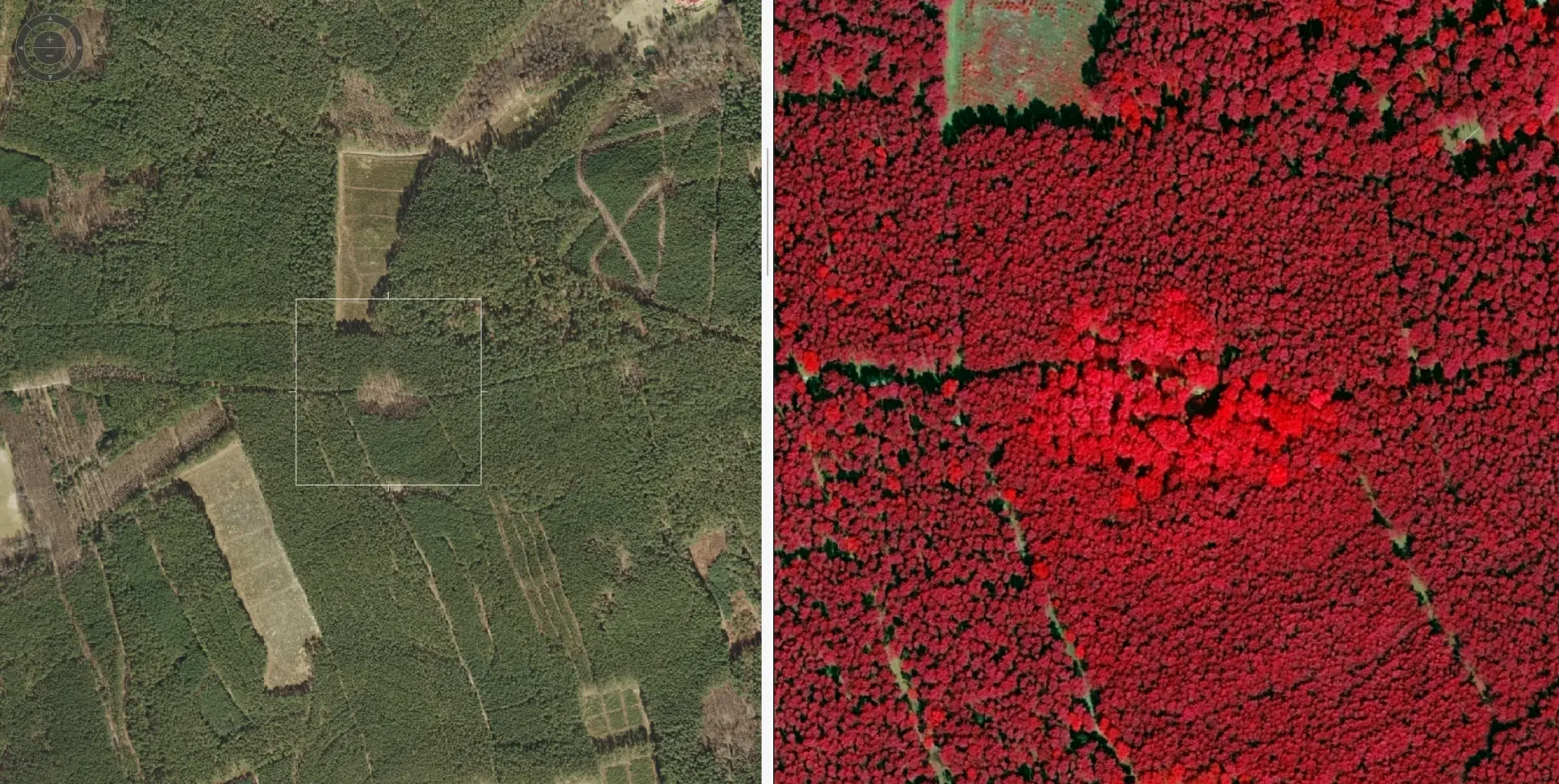
The Geoinformatics Laboratory works closely with the PTK Drone Centre, which specialises in comprehensive data acquisition using unmanned aerial vehicles (UAVs). The joint activities of both units enable the implementation of the full cycle of geoinformatics projects – from planning aerial missions, through the acquisition of photogrammetric and remote sensing data, to their advanced analysis, interpretation and presentation of results. We offer a wide range of services: orthophotomaps, 3D models, digital terrain models and land cover models, thermal imaging, and infrastructure inspections. Thanks to this close collaboration, we are able to deliver consistent, high-quality geoinformation products that support scientific, engineering and environmental projects at various spatial scales.
Research and development capabilities
- the creation of 3D digital models of cities, known as ‘digital twins’,
- detection of changes in land cover and land use,
- GIS analyses for use by spatial planners, local authority offices, statistical offices, emergency response centres, and government
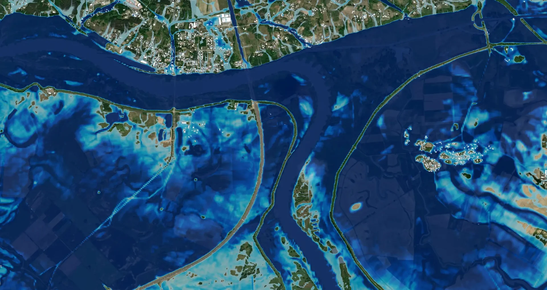
and local government agencies, - analysis of the state of water resources in the region and their use, hydrological modelling (e.g. flood simulation),
- the study and modelling of environmental phenomena and processes,
- analyses of environmental and climate changes at regional level,
- support for Smart City and Smart Village projects.
Scope of services
The Centre offers services to public administration bodies, local government bodies, commercial enterprises and academic institutions, including:
- Exploration and analysis of data from satellite navigation systems (GPS, Galileo) in civilian applications (transport, logistics, communications).
- Analysis of land use in the context of spatial development planning.
- Assessment and updating of planning and cartographic documentation for the benefit of managing bodies.
- Analysis of land use and land cover for companies undertaking construction projects.
- Analysis and modelling of the state of water resources within the region and their use.
- Analysis and modelling of environmental phenomena and processes.
- The use of satellite data for geodetic surveying.
- Analysis and processing of satellite data for the purpose of delimiting areas with a specified land-use category and other classification criteria.
- Analysis and identification of degraded areas, including unauthorised waste dumps.
- Analysis and enhancement of spatial models of urban areas in accordance with the CityGML standard.
IT Resources Laboratory
Server:
- 2 AMD EPYC Rome 7352 processors (24 cores, 2.3 GHz).
- 512 GB of RAM.
- 8 SATA 3, 6 Gbit/s drives, each with a capacity of 18 TB.
- 4 NVMe drives, each with a capacity of 3.84 TB, plus a 1 TB NVMe system drive.
- 2x 10 GB Ethernet.
- 2 NVIDIA A40 graphics cards (expandable to 8 cards).
Workstations:
- Intel i9-12900K processor.
- 128 GB RAM.
- 2 x 1 TB NVMe drives.
- NVIDIA RTX A5000 graphics card.
- 2 x 27-inch 4K monitors.
Software available in the laboratory
HEXAGON ERDAS Imagine • An advanced satellite imagery processing tool that enables the analysis and interpretation of images across various domains (optical, radar, lidar).
HEXAGON ERDAS Apollo • Geoserver. A platform for the publication, distribution and ‘on-the-fly’ analysis of large geospatial datasets. It enables data to be published on geoportals.
ER Mapper • Advanced software for raster and image data processing, designed for geological analyses, including 3D.
ESRI ArcGIS Pro • Leading GIS software for map creation, spatial analysis and geospatial data management. Used across a range of sectors for spatial planning and environmental analysis.
Trimble eCognition • A tool for the automatic classification and analysis of images, based on image segmentation using an object-based approach. It is a highly advanced and efficient system for extracting qualitative information from images
Virtual City Suite + BREC • Software for 3D city modelling, used to create digital spatial models (digital twins). It enables the simulation of urban development processes and spatial planning.
Limon • An app for processing LiDAR point cloud data.
Offer for businesses
The laboratory is available both for hire by companies and research institutions, and for the Park’s team to carry out research on a contract basis. Thanks to its state-of-the-art infrastructure, companies can conduct advanced research independently or commission PTK – R&D&I specialists to carry it out.
Contact
Companies interested in hiring a laboratory or commissioning tests are asked to contact us:
- Laboratory Coordinator:
- Infrastructure Management and Laboratory Services Department: m.szymanski@ptklubuskie.com
We encourage you to collaborate with us and make use of the Space Technology Park’s state-of-the-art research facilities!